Orbae Pro
Designed for the corporate user, Orbae Pro unlocks more ways to explore Orbae data for better strategizing, reporting and action-taking.
Try it for yourself. Create a free account and visit the datasets for soy in Brazil and palm in Malaysia.
Deep dive into what each feature does and how to use them. For full access to Orbae Pro, contact us.
Features
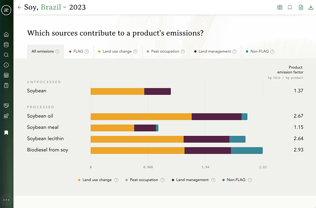
Product emissions
Uncover how land conversion, land management, transport and processing contribute to the total emissions of a product.
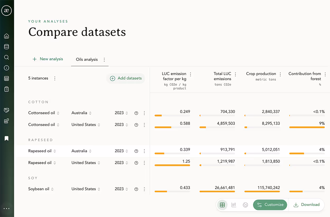
Custom analyses
Compare the commodities and geographies of your choice using the indicators you select.
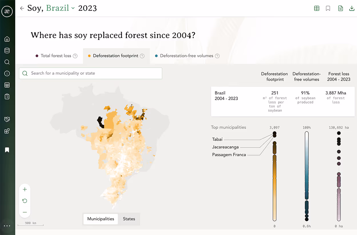
Forest loss
See your exposure to forest loss at national and subnational level over the past 20 years, and assess how forest loss varies across a country.
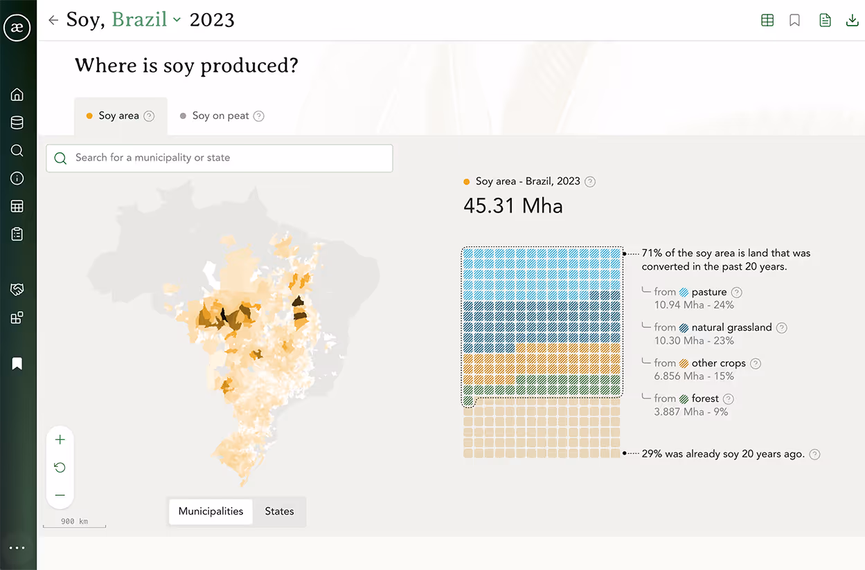
Land occupation
Assess the amount of land used to produce a commodity.
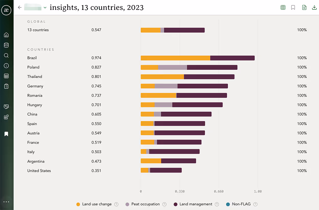
Commodity insights
Get a global perspective on the environmental costs of land conversion for a particular commodity across producing countries.
Datasets for baseline years
Update your baseline with data for prior assessment years.
More coming soon
We're piloting biodiversity and water risk assessments with Orbae Pro users. To get involved, contact us.